
We've turned our GeoActivities for every lesson into hands-on, interactive activities developed for use on both SMART and Promethean platforms.

Quickly and easily introduce a lesson, chapter, or unit with ready-to-use presentations including photos, videos, maps and more!
Maps & Graphs
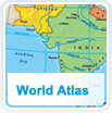

The Online World Atlas is a comprehensive collection of World Cultures and Geography's Student Edition maps formatted for projection and online use. Sample maps from South Asia include:
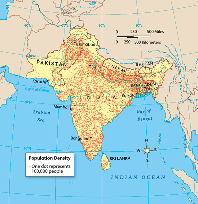
• South Asia Population Density
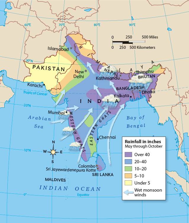
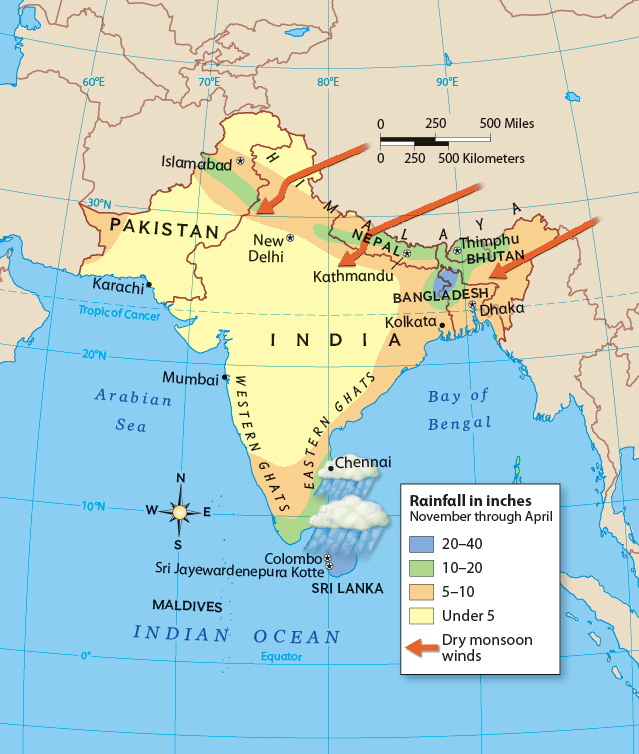
• Summer Monsoon: Avg. Summer Precipitation
• Winter Monsoon: Avg. Winter Precipitation
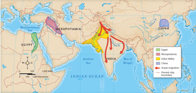
• Ancient River Valley Civilizations
• South Asia Population Density
• Summer Monsoon: Avg. Summer Precipitation
• Winter Monsoon: Avg. Winter Precipitation
• Ancient River Valley Civilizations
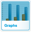
This resource includes all Student Edition graphs formatted for projection and online use. Sample Graphs from South Asia include:
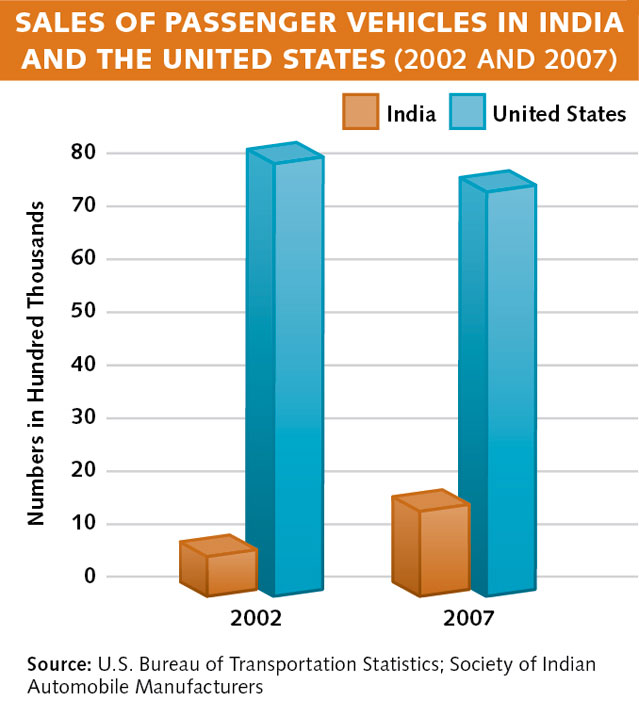
• Sales of Passenger Vehicles in India and the
United States (2002 & 2007) Chapter 17
Section 2.3
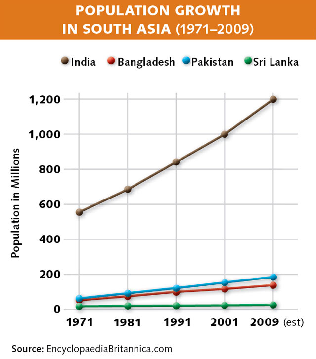
• Population Growth in South Asia (1971 to
2009) Chapter 17 Section 2.3
• Sales of Passenger Vehicles in India and the
United States (2002 & 2007) Chapter 17
Section 2.3
• Population Growth in South Asia (1971 to
2009) Chapter 17 Section 2.3
A comprehensive collection of over 190 Outline Maps created by National Geographic cartography experts using the Interactive Map Tool. Sample Outline Maps for South Asia include:
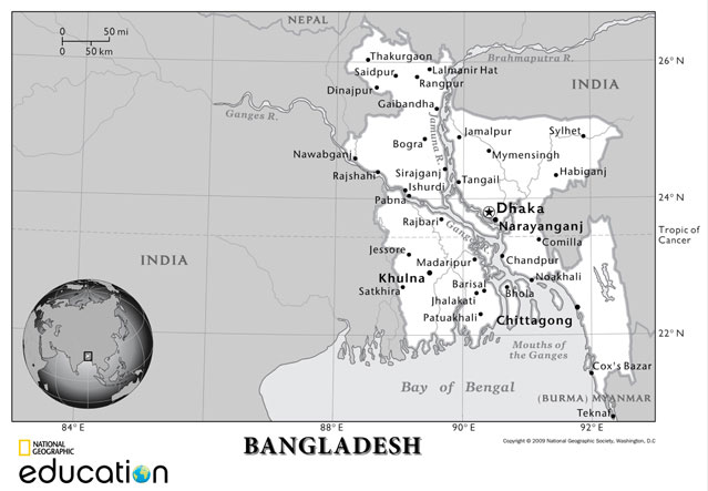
• Bangladesh Outline Map
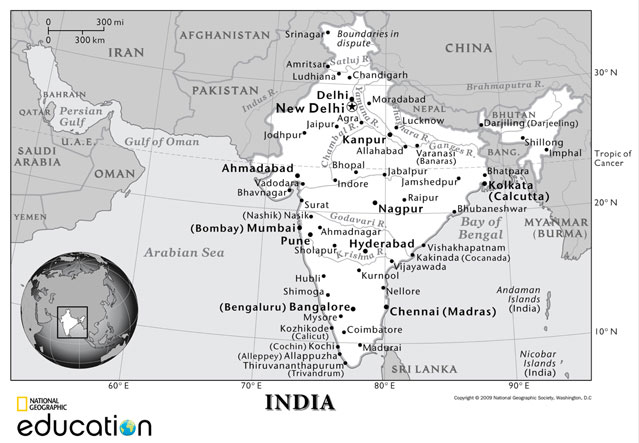
• India Outline Map
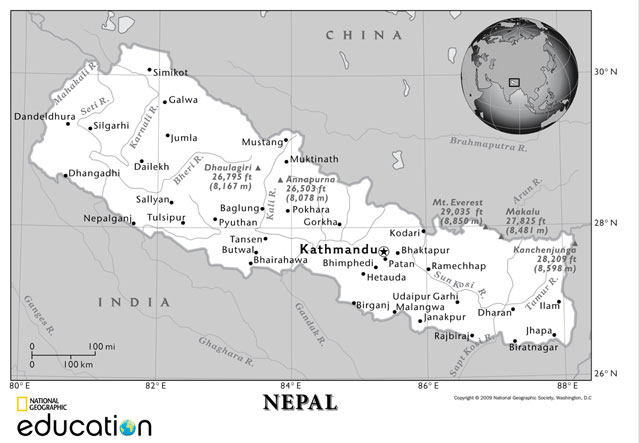
• Nepal Outline Map
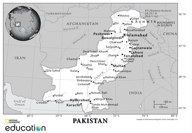
• Pakistan Outline Map
• Bangladesh Outline Map
• India Outline Map
• Nepal Outline Map
• Pakistan Outline Map
Digital Library
Teacher Tools


Assessment resources include standardized test practice, section quizzes, chapter tests at two different reading levels, and ongoing assessment such as document-based questions and rubrics. Sample Assessment for South Asia includes:
• Chapter 17 Section 1 Quiz
• Chapter 17 Chapter Test (on-level)
• Chapter 17 Chapter Test (modified)
• Standardized Test Practice
• Chapter 17 Section 1 Quiz
• Chapter 17 Chapter Test (on-level)
• Chapter 17 Chapter Test (modified)
• Standardized Test Practice
Resources from program consultants and tutorials to enhance lesson delivery and encourage best practices
A collection of online resources and ready-to-use presentations and other teaching materials. Sample Teacher Resources for South Asia include:
• Grain Production and Population
(1950-2008) Chart
• Review and Assessment
• Reading and Note-Taking
• Vocabulary Practice
• GeoActivity
• Grain Production and Population
(1950-2008) Chart
• Review and Assessment
• Reading and Note-Taking
• Vocabulary Practice
• GeoActivity
A fun and engaging application that provides students with the tools they need to create online and print magazines and other projects in a variety of media
Teachers can use the Lesson Planner to plan and share their instruction for each day. Lessons are made up of activities and details include resource previews and standard correlations.


© 2011 National Geographic School Publishing
| Terms of Use & Privacy Policy