

The World Cultures and Geography Student Edition is online. Find hundreds of supporting images, maps, unit opener videos, explorer video clips, modified text for struggling readers, audio support and much more at point-of-use within the book pages.
The Online World Atlas is a comprehensive collection of World Cultures and Geography's Student Edition maps formatted for projection and online use. Sample maps from South Asia include:
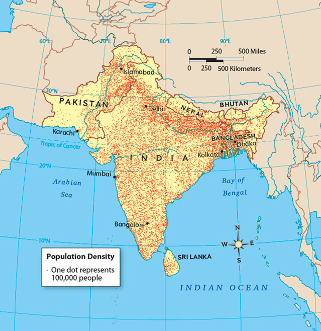
• South Asia Population Density
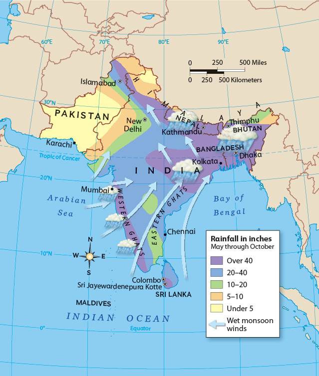
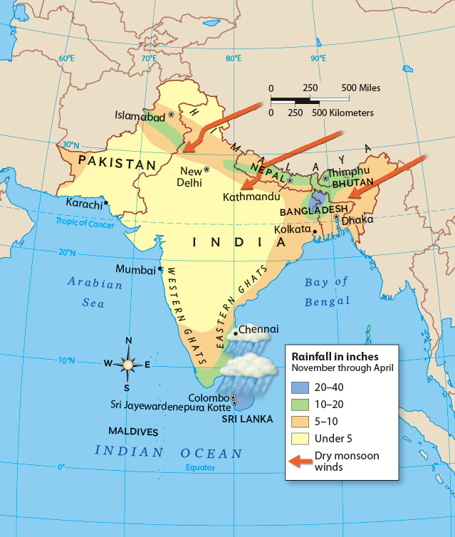
• Summer Monsoon: Avg. Summer Precipitation
• Winter Monsoon: Avg. Winter Precipitation
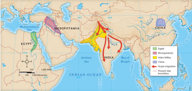
• Ancient River Valley Civilizations
• South Asia Population Density
• Summer Monsoon: Avg. Summer Precipitation
• Winter Monsoon: Avg. Winter Precipitation
• Ancient River Valley Civilizations
This resource includes all Student Edition graphs formatted for projection and online use. Sample Graphs from South Asia include:
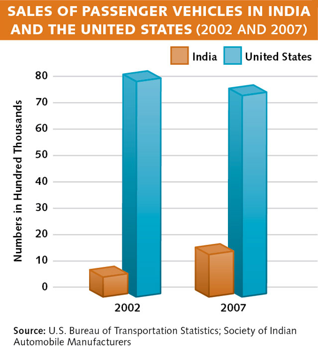
• Sales of Passenger Vehicles in India and the
United States (2002 & 2007) Chapter 17
Section 2.3
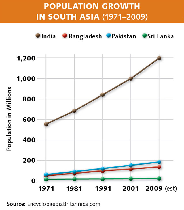
• Population Growth in South Asia (1971 to
2009) Chapter 17 Section 2.3
• Sales of Passenger Vehicles in India and the
United States (2002 & 2007) Chapter 17
Section 2.3
• Population Growth in South Asia (1971 to
2009) Chapter 17 Section 2.3
A comprehensive collection of over 190 Outline Maps created by National Geographic cartography experts using the Interactive Map Tool. Sample Outline Maps for South Asia include:
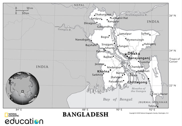
• Bangladesh Outline Map
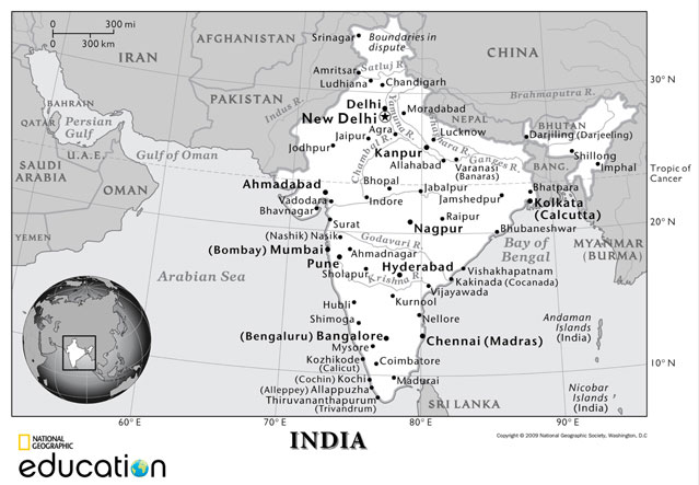
• India Outline Map
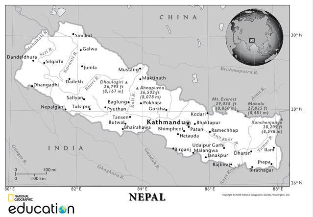
• Nepal Outline Map
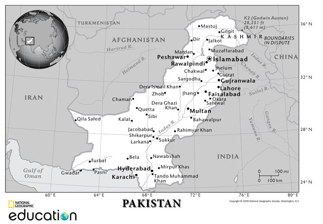
• Pakistan Outline Map
• Bangladesh Outline Map
• India Outline Map
• Nepal Outline Map
• Pakistan Outline Map


Digital Library


Interactive Map Tool
Developed by National Geographic Education Foundation, the Interactive Map Tool provides regularly updated data sets and outline maps to help students learn valuable map skills.
Student Tools


A collection of online resources for students including Charts and Infographics, Graphic Organizers, Graph Paper, and Guided Writing Instruction, and Writing Templates.
A fun and engaging application that provides students with the tools they need to create online and print magazines and other projects in a variety of media


© 2011 National Geographic School Publishing
| Terms of Use & Privacy Policy